The past week of west Texas weather has been fairly tame with occasional high-level clouds, mild afternoons, and seasonably chilly mornings only occasionally interrupted by a weak cold front. This overall weather pattern will carry us into the weekend.
A southwesterly breeze will add to the chill Friday morning – the coldest start in about a week – then will boost afternoon temperatures to comfortable levels. Friday afternoon high temperatures will range from the mid 60’s to lower 70’s. The city of Lubbock should top-out very close to 70° between 2 and 4 PM. At the same time, southwest winds will be gusty. Sustained speeds of 15-25 MPH, and a few gusts up to 35 MPH are expected.
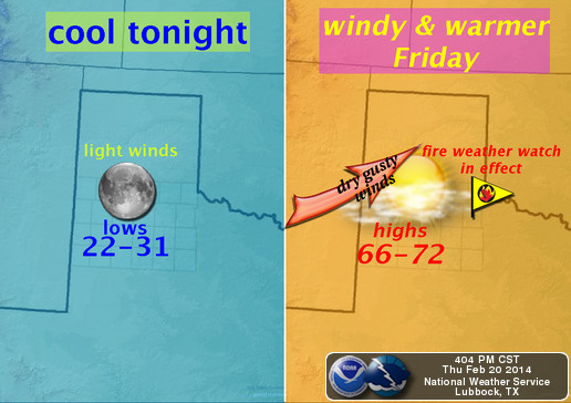
Graphic courtesy NWS Lubbock.
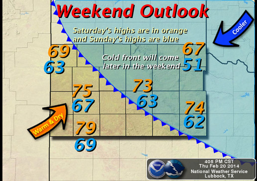
Afternoon winds will diminish after sunset, leaving behind relative calm and seasonable evening temperatures. Saturday morning is going to be on the cool side, but near-normal compared to late-February standards. By Saturday afternoon, temperatures soar once again. High temps should reach values in the 70’s in Lubbock and near 80° southwest of the Hub City.
A cold front will move through northwest Texas Saturday night or early Sunday morning. Behind it, cooler air will be ushered into our region by a gusty north wind. Sunday afternoon will still be nice, with high temperatures in the 50’s & lower 60’s. Though, a far cry from Saturday’s spring-like warmth.
Wreck ‘Em,
Cutter Martin