Last night, a line of thunderstorms that developed over eastern New Mexico and the Texas panhandle brought gusty winds and heavy rain to portions of the South Plains early Monday morning. This afternoon, the sun will continue to shine and moisture continue to increase; setting the stage for another round of storms tonight.
Storms will develop over the mountains and New Mexico Monday afternoon. Upper-level winds, or winds above the surface, will push these storms southeastward. This general motion increases the likelihood that storms will move into the general Lubbock area. Timing wise, rain and storm chances will begin to increase after 8 PM in Lubbock; peaking after midnight.
The strongest storms will be capable of producing wind gusts over 60 MPH, blowing dust, and large hail. Considering the amount of moisture that is present across our region, very heavy rain and localized flooding may also occur under a few storms. This same general weather pattern will remain in-place through the next few days. Several more rounds of storms are possible through Thursday morning.
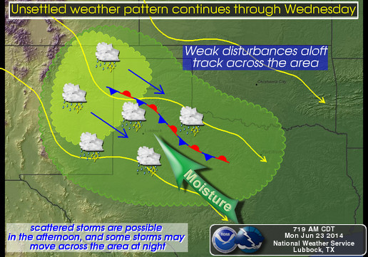
Graphic via the National Weather Service office in Lubbock.
Wreck ‘Em,
Cutter Martin